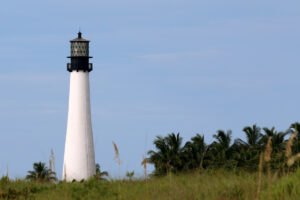
Bill Baggs Cape Florida State Park is located on the southern portion of the island of Key Biscayne and is home to Cape Florida Light, which is said to be the oldest standing structure in the Miami area, except for St. Bernard de Clairvaux Church. The lighthouse was initially built in 1825 and was reconstructed in 1846, according to Florida State Parks, which owns the structure today. In addition, the state park offers ample beach space for those who want to take a dip in the water while avoiding the city’s other busy beaches.
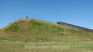
The sprawling 2,200-acre Cahokia Mounds complex in Collinsville, Ill., are some of the most impressive Native American mounds in the country. While settlement in the area may date to roughly 1200 BC (during the Late Archaic period), the mounds as they are today were settled circa 600 AD (during the Late Woodland period). The mounds were probably built during the 9th century during the Emergent Mississippian cultural. The settlement has the distinction of being the largest, most influential urban settlement of the Mississippian culture.
62234
28720
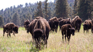
Custer State Park includes more than 71,000 acres and is South Dakota’s first and largest state park. The state park and wildlife reserve is home to an assortment of animals, including free-roaming bison and prairie dogs. The park, established in 1912 and named for Lt. Col. George Armstrong Custer, is famous for Needles Highway and its wildlife loop, offering incredible views of a bison herd and prairie dog towns. In the 1930s, the Civilian Conservation Corps built roads and laid out campgrounds
57730
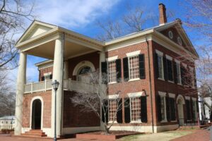
The 1836 Lumpkin County Courthouse in downtown Dahlonega, Ga., is home to the Dahlonega Gold Museum Historic Site. Located on the town square, the courthouse is the oldest surviving courthouse building in the state, serving in that capacity until 1965. The state park is a testament to the first major gold rush in the nation. The museum collection includes exhibits about how gold is mined, tools miners used and actual samples of gold. The building features wooden seats from 1889 and the judge’s chambers.
30533
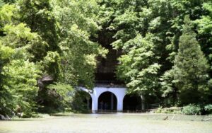
By the 1930s and 1940s, Dunbar Cave was a popular destination, not so much because of its natural splendor, but because of the musical acts that performed at the cave entrance. The 8-mile-long Dunbar Cave was formed millions of years ago and has always attracted people. During digs at the site, archeologists found Paleo-Indian artifacts buried near the cave entrance, and in 2005, Indian glyphs were discovered on the cave walls.
37043
Located on the north shore of the Etowah River and south of modern-day Cartersville, the mounds were inhabited from 1000 to 1550 by Muskogean Native Americans of the Mississippian culture, so named because the culture originated along the banks of the Mississippi River. Designated a National Historic Landmark in the 1960s, this 54-acre state park includes a museum with artifacts discovered at the site, six mounds the natives built, and a number of other related sites. The now 1,000-year-old Native American town is generally believed to be a city Hernando de Soto visited in 1540 when he was exploring the area. By that time, according to historians, the civilization was in decline and the Etowah Indian Mounds may have been abandoned.
30120
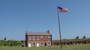
Construction on Fort Clinch started in 1847 after the Second Seminole War on a peninsula near Amelia Island’s northernmost point. The only battle at the fort, named in honor of General Duncan Lamont Clinch, a leader in the First and Second Seminole Wars, happened during the Civil War. In 1862, Union troops recaptured the fort after Confederates seized control of the structure. The state of Florida bought the fort in 1935. Today, the fort is part of the 1,100-acre Fort Clinch State Park, which opened to the public in 1938.
32034
Built in 1721, a dozen years before the first city in Georgia, Savannah, was founded, Fort King George was both the first English settlement on Georgia’s coast and the British Empire’s southernmost outpost in North America. It remained the southernmost settlement until 1736 when Fort Frederica was built on what is today St. Simon’s Island. With the help of historic drawings, the Lower Altamaha Historical Society and the Georgia Department of Natural Resources in 1988, a number of the fort’s structures were rebuilt, including the cypress blockhouse. The reconstructed fort is a replica of Barnwell’s original construction. Today, the park highlights the area’s 18th century cultural history, including the Guale Indians, the 17th century Spanish mission Santo Domingo de Talaje, Fort King George and the Scottish colonists. In addition, the state park features information about 19th century sawmilling.
31305
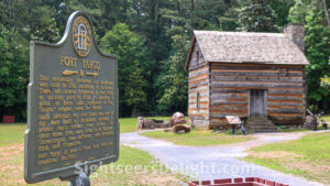
The first European settlers came to the area in the late 1700s and built a series of forts, including Fort Yargo, to protect themselves from the natives. The 260-acre Fort Yargo State Park is home to a long fort was built in 1792 or 1793. The structure may have been built at the request of the Creek Indians who were then at war with the Cherokees. The Creeks likely were the first Indians to arrive in the area of what is now Barrow County and created the village of Snodon in what is now downtown Winder.
30680

