
[su_service title=”Traveling Across Metro Atlanta” icon=”icon: star” icon_color=”#295c7d” size=”48″]Traveling around Atlanta without a car can be a bit challenging. But, this guide will help visitors travel from one end of the region to the other.[/su_service]
[su_icon icon=”icon: train” background=”#ffffff” color=”#295c7d” size=”48″][/su_icon]
Metropolitan Atlanta Rapid Transit Authority (MARTA)
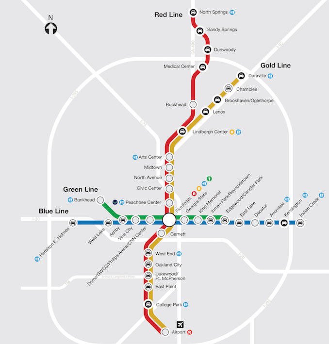
One viable option for traveling around Atlanta is MARTA, a network of heavy rail and bus routes. The MARTA rail system has 38 stations on four lines (red, gold, blue and green).
Visitors should look at the system like a plus symbol with an east-west line and a north-south line; the two intersect at Five Points in Downtown. The northern route splits to a northern route (red) and a northeastern one (gold).
MARTA is an excellent option for travelers arriving via airplane. Anyone heading into the city should take a red or gold train.
Key stops and sites include:
[su_list icon=”icon: check” icon_color=”#295c7d”]
- Dome/GWCC/Philips Arena/CNN: Inside CNN Atlanta Studio Tour, College Football Hall of Fame, Georgia Aquarium, Center for Civil and Human Rights and the World of Coca-Cola
- Georgia State: Georgia Capitol Museum
- Arts Center: High Museum of Art, Rhodes Hall
- Midtown: Atlanta Monetary Museum, Margaret Mitchell House
- Buckhead: Lenox Square, Phipps Plaza
[/su_list]
Click here for a map of the MARTA rail system. For more information, visit itsmarta.com.
Atlanta Streetcar
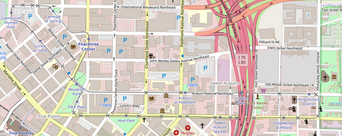
The Atlanta Streetcar runs a 2.7-mile loop between Centennial Olympic Park and the Martin Luther King, Jr. National Historic Site. The streetcar connects with MARTA at Peachtree Center.
Key stops and sites include:
[su_list icon=”icon: check” icon_color=”#295c7d”]
- Centennial Olympic Park: College Football Hall of Fame, Georgia Aquarium, Center for Civil and Human Rights and the World of Coca-Cola
- King Historic District: Martin Luther King Jr. National Historical Park
- Sweet Auburn Market: Sweet Auburn Market
[/su_list]
For more information, visit itsmarta.com/streetcar/.